Printable Journal de randonnée
Suivez chaque sentier, sommet et aventure en plein air
A comprehensive hiking log to record trail details, distance, elevation gain, weather conditions, terrain, and personal highlights from every hike. Build a complete archive of your outdoor adventures and watch your hiking progress grow over time.
Personnaliser les champs
Activez ou désactivez les champs. Cliquez sur le crayon pour renommer, ou ajoutez vos propres champs.
Avantages
Comment utiliser
Qu'est-ce que ce journal ?
A hiking journal is a structured log for documenting every trail you conquer. By recording distance, elevation gain, duration, and difficulty alongside terrain notes and trail highlights, you build a comprehensive outdoor adventure record that helps you track fitness progress and plan future hikes.
This journal is for hikers of all levels — from casual day-hikers exploring local trails to serious trekkers building toward ambitious peak goals. It serves as both a fitness log and a trail guide you write for yourself, preserving details about conditions, difficulty, and standout moments that make returning to a trail (or recommending it) much easier.
Outdoor recreation research shows that people who log their hikes are more consistent in their practice, push themselves more progressively, and report higher satisfaction from the activity. The act of recording trail details also deepens your connection to nature by training you to observe more carefully — the terrain, the weather, the wildlife, and the subtle details that make each hike unique.
Exemple rempli
Voici à quoi ressemble une entrée typique une fois remplie :
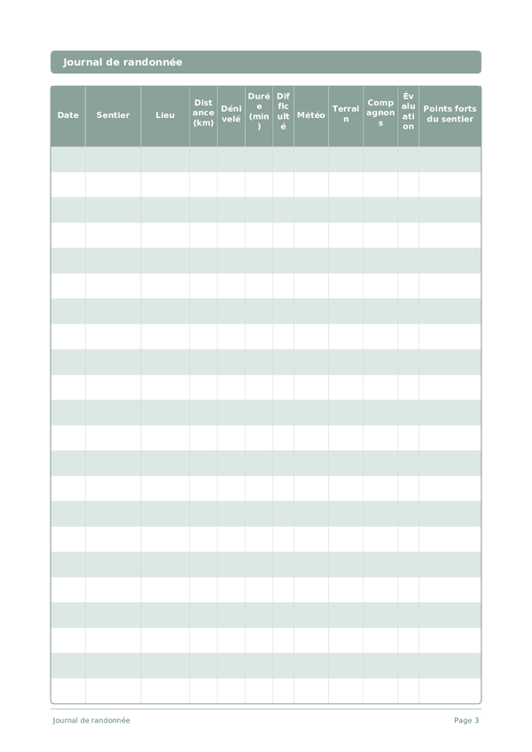
| Date | Sentier | Lieu | Distance (km) | Dénivelé | Durée (min) | Difficulté | Météo | Terrain | Compagnons | Évaluation | Points forts du sentier |
|---|---|---|---|---|---|---|---|---|---|---|---|
| 2025-03-01 | Eagle Creek Trail | Columbia River Gorge, OR | 12.4 | 520 | 4h 15m | 6 | Partly cloudy, 12C | Mixed — packed dirt, rocky switchbacks, creek crossings | Solo | 9 | Tunnel Falls at mile 6 — walked behind a 50-foot waterfall through a carved rock tunnel. Punchbowl Falls viewpoint was stunning. |
| 2025-03-04 | Multnomah Falls Loop | Columbia River Gorge, OR | 5.2 | 410 | 2h 30m | 5 | Light rain, 9C | Paved start, then steep rocky switchbacks | Jamie, Alex | 7 | The falls were powerful after recent rain. Upper viewpoint was foggy but atmospheric. Slippery in spots — proper boots essential. |
| 2025-03-08 | Silver Falls South Loop | Silver Falls State Park, OR | 11.8 | 380 | 4h 00m | 4 | Overcast, 11C | Well-maintained, some muddy sections | Hiking group (6) | 8 | Ten waterfalls in one loop! South Falls walk-behind was the highlight. Trail was muddy but passable. Great for groups. |
Comment remplir chaque champ
Chaque page est un tableau avec des colonnes. Remplissez une ligne par entrée. Voici à quoi sert chaque colonne :
Date
Inscrivez la date du jour. Cela ancre votre entrée dans le temps et aide lors de la relecture ultérieure.
Sentier
Lieu
Où la photo a-t-elle été prise ?
Distance (km)
Enregistrez la distance parcourue (en km ou miles). Voir votre distance augmenter au fil des semaines est un puissant facteur de motivation.
Dénivelé
Durée (min)
Enregistrez la durée de votre exercice ou de votre pratique en minutes. Suivre la durée vous aide à voir votre engagement grandir et à trouver la durée de séance optimale.
Difficulté
Météo
Ensoleillé, nuageux, pluie, vent — conditions actuelles
Terrain
Compagnons
Qui vous a accompagné lors de cette sortie camping ?
Évaluation
Note globale de l'expérience
Points forts du sentier
Conseils pour réussir
Quand et à quelle fréquence écrire
Fill in one row per hike, ideally within a few hours of finishing while details like distance, time, and conditions are precise. If you hike weekly, review your log monthly to spot fitness trends \u2014 the same trail getting easier is the clearest sign of progress. Seasonal hikers should review at the start of each season to remember gear lessons and trail conditions from the same period last year.
Questions fréquentes
Quelles informations noter après chaque randonnée ?
Consigne les données essentielles : distance parcourue, dénivelé positif, durée, conditions météo et niveau de difficulté de 1 à 5. Ajoute une section « Points forts » pour capturer ce qui t'a marqué — une vue, une rencontre, un moment de silence. L'American Hiking Society recommande de noter aussi l'état du sentier (boue, neige, obstacles) pour planifier tes prochaines sorties.
Comment évaluer honnêtement la difficulté d'un sentier ?
Utilise une échelle de 1 à 5 en combinant distance, dénivelé et technicité du terrain. Un sentier court mais très pentu peut valoir un 4, tandis qu'un long plat restera un 2. Note aussi ta forme du jour : le même sentier peut sembler plus difficile par chaleur ou après une mauvaise nuit. Cette honnêteté dans l'évaluation te permet de progresser sans te mettre en danger.
Pourquoi noter la météo pendant la randonnée ?
La météo influence directement ta sécurité et ton expérience. Note la température au départ et à l'arrivée, la couverture nuageuse, le vent et toute précipitation. Ces données t'aident à anticiper les conditions saisonnières, à mieux t'équiper et à repérer les fenêtres météo idéales sur tes sentiers préférés. Elles servent aussi de référence si tu retournes sur le même itinéraire à une autre saison.
Comment le journal de randonnée améliore-t-il ma forme physique ?
En suivant distance, dénivelé et durée au fil du temps, tu peux observer ta progression concrète. Florence Williams, dans *The Nature Fix*, montre que l'exposition régulière à la nature réduit le cortisol et améliore les capacités cardio-vasculaires. Ton journal te révèle les paliers franchis, te motive dans les périodes de stagnation et t'aide à planifier une montée en charge progressive.
Comment documenter les paysages et la faune rencontrés ?
Décris ce que tu vois, entends et ressens : la texture d'une roche, le cri d'un oiseau, l'odeur de sous-bois après la pluie. Note les espèces observées avec l'heure et le lieu. Tu peux ajouter des croquis rapides ou coller des photos imprimées. Ces détails sensoriels rendent tes souvenirs beaucoup plus vivants que de simples données chiffrées.
Quelle est la durée minimale en nature recommandée chaque semaine ?
Une étude de White et al. (2019) établit un seuil de 120 minutes par semaine en espaces naturels pour un bénéfice mesurable sur le bien-être. Cela peut se répartir en plusieurs sorties courtes. Ton journal de randonnée te permet de vérifier facilement si tu atteins ce seuil et d'ajuster ton planning si besoin.
Comment préparer une randonnée grâce aux notes passées ?
Relis tes entrées précédentes sur le même sentier ou des sentiers similaires. Vérifie l'état du terrain à la même saison, le matériel que tu avais emporté (et ce qui t'avait manqué), la durée réelle vs estimée. Ces informations personnalisées valent bien plus que les fiches génériques en ligne, car elles tiennent compte de ton rythme et de tes préférences.
Mon journal de randonnée peut-il m'aider à fixer des objectifs ?
Absolument. Après quelques semaines de notes, tu identifies des patterns : les sentiers qui te procurent le plus de plaisir, les distances confortables, les dénivelés qui te challengent sans t'épuiser. Tu peux alors fixer des objectifs concrets — un 50 km en fin d'année, un sommet particulier, une semaine de randonnée itinérante — et suivre ta progression entrée après entrée.
Vous aimerez aussi
Journal de nature
Observez, émerveillez-vous et connectez-vous avec le monde naturel
Journal d'ornithologie
Notez chaque observation d'oiseau avec l'espèce, l'habitat et le comportement
Journal de jardin
Planifiez, suivez et apprenez de chaque saison de culture
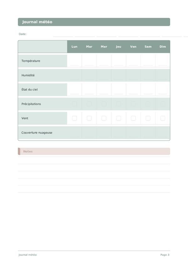
Journal météo
Observations météorologiques quotidiennes pour météorologues amateurs
Molette pour zoomer, glisser pour déplacer